
People
Downloads
| Attachment | Size |
|---|---|
| IcySea-Guidelines.pdf | 438.32 KB |
| IcySea-Sentinel1.pdf | 744.48 KB |
| IcySea-SIC.pdf | 3.75 MB |
| IcySea-Ice-Drift-Forecasts.pdf | 969.26 KB |
| IcySea-Automatically-classified-Sentinel.pdf | 511.33 KB |
Drift+Noise Polar Services GmbH is a spin-off company of the Alfred Wegener Institute for Polar and Marine Research (AWI). The founders look back on more than 15 years of operational experience in polar regions.
Drift+Noise is fully committed to assisting stakeholders acting in polar waters with operational ice information from models and satellites, by leveraging technology from polar research, geophysics, and remote sensing.
We are looking for early-adopters in the marine and polar market who are presently investing in the digitization of their operations. We integrate Agile and DevOps practices to ensure the high quality of our operational services; concepts such as code revision, test driven development, and continuous integration are used in our daily workflow.
Key users of our services include icebreakers like Polarstern (the German national icebreaker operated by the AWI) and Aurora Australis (chartered by the Australian Antarctic Division), expedition cruise companies such as Hapag Lloyd Cruises and Marine Technology and Engineering Organisations like the Hamburg Ship Model Basin (HSVA).
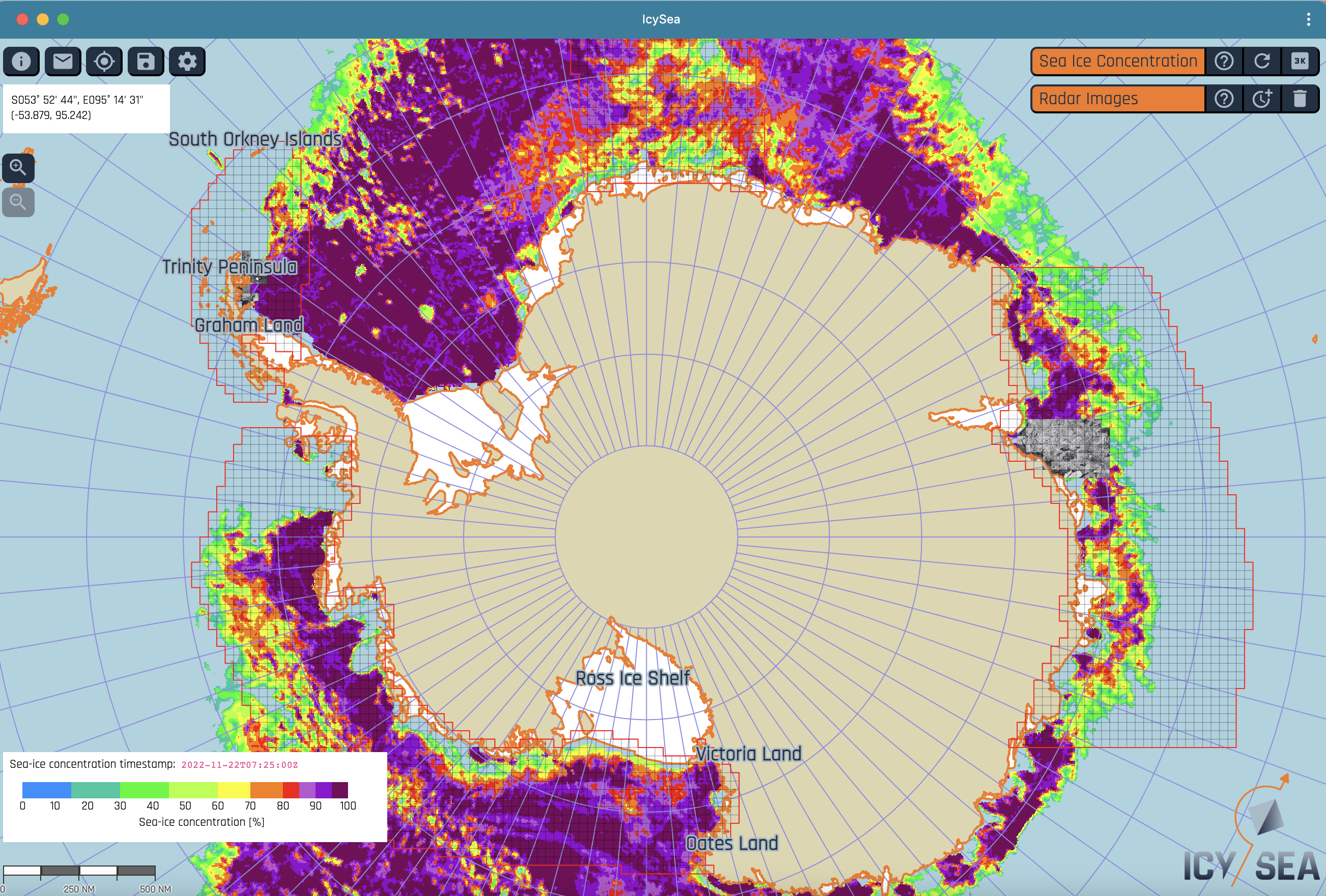
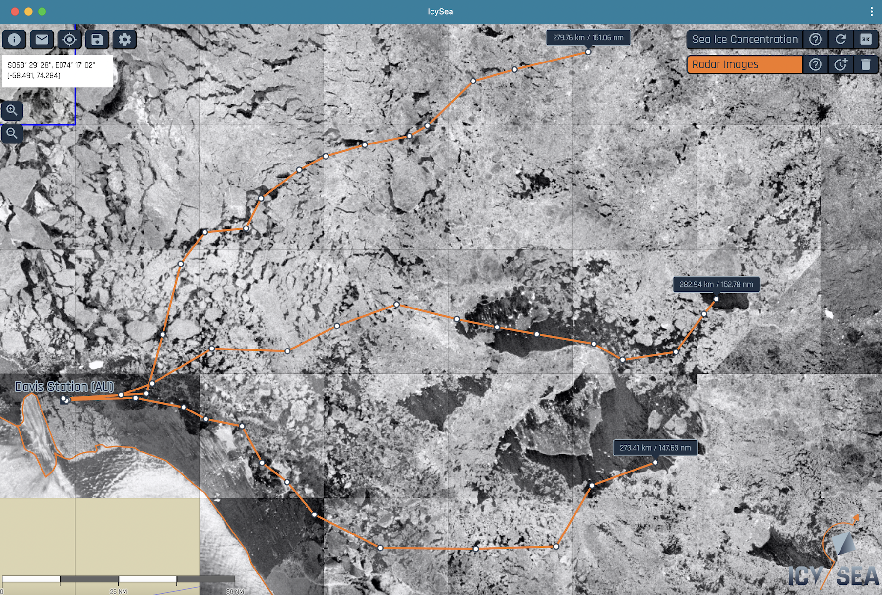
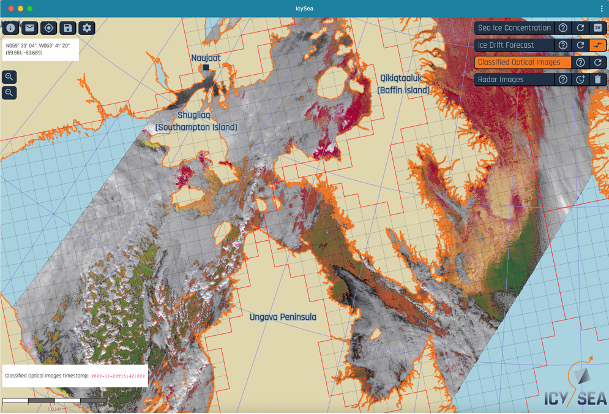
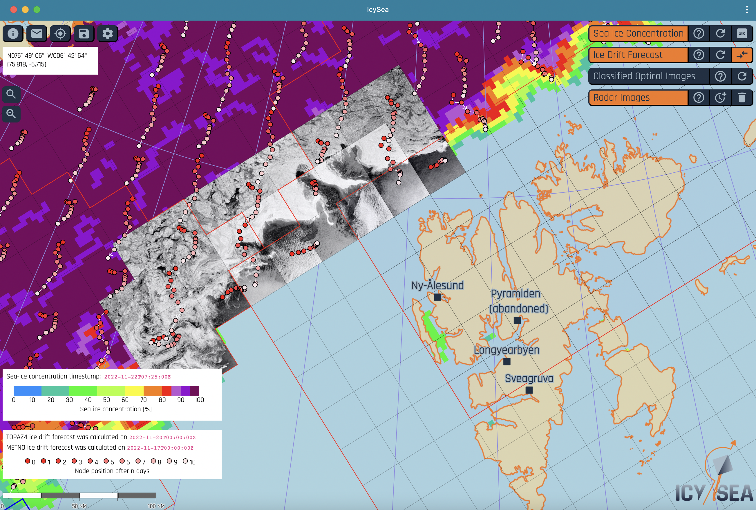
IcySea - An ice information app for navigation in polar regions
IcySea is a map-based application designed to display and deliver ice relevant information for operational purposes in the polar regions. It is addressed to national and local authorities, as well as to commercial and non-commercial users (for example: tourism, fisheries, research, offshore, and surveying vessels).
The IcySea-backend structure merges high resolution satellite imagery and optimized bias corrected ice drift modeled data in an automated fashion. Data transmission to the IcySea-frontend client software occurs in near real time and is optimized for low bandwidth connections (tested and proven with an Iridium connection). The graphical user interface is designed to smoothly integrate with the work processes on board a ship and to enable quick navigational decision making. IcySea enables the user in the ice to capture the present and future dynamics of sea-ice whilst using high resolution Sentinel-1 radar satellite images for routing decisions. The service is available Arctic and Antarctic wide.
Follow us